We walk. We follow the Gaodepu and aim for its head below Mount Jifu: the source of the Mekong.
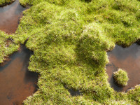
We make our way through a wetland, finding our footing on hummocks. It isn’t difficult, just tiring after a while.
Further up the ground becomes more solid, consisting of stones and pebbles.
Impatience.
We pass the spot where I turned around last year. After I got home, it seemed on Google Earth to be 140 meters or so away from where the river starts. Indeed a little further on we get to this Tibetan style marker of the Mekong’s source. Source?

Disappointment. No glacier, no spring, no pool where water flows from. Instead the lower part of a rocky slope. Here and there tiny streams can still be seen trickling down between the stones. We move higher up and find a first patch of melting ice, and yet higher up a second patch. Feels more like it. We shoot our source pictures. But now we see the edge of the glacier, high above us still. Luciano hesitates: ‘That is at least another hour’. But I can’t turn around now. We start climbing again. Soon it is my turn to hesitate. I feel uneasy on this steep slope of loose stones, slip a few times.

‘Look for bigger stones and keep walking’, says Luciano. That’s what I do. From then on I am not aware of anything.
I am sitting at the foot of the glacier. I think the final climb has taken me five minutes. I remember nothing. Luciano says it has been about forty, with several short breaks.
My GPS reads N 33.45.677, E 94.40.562, altitude 5.374 meters. This is the highest source of the Mekong at the head of its longest branch.
Joy.

Weather has been good to us today. Hail and rain when we descend, but mild this time. My shoes leak, I didn’t use them in wet conditions for a year.